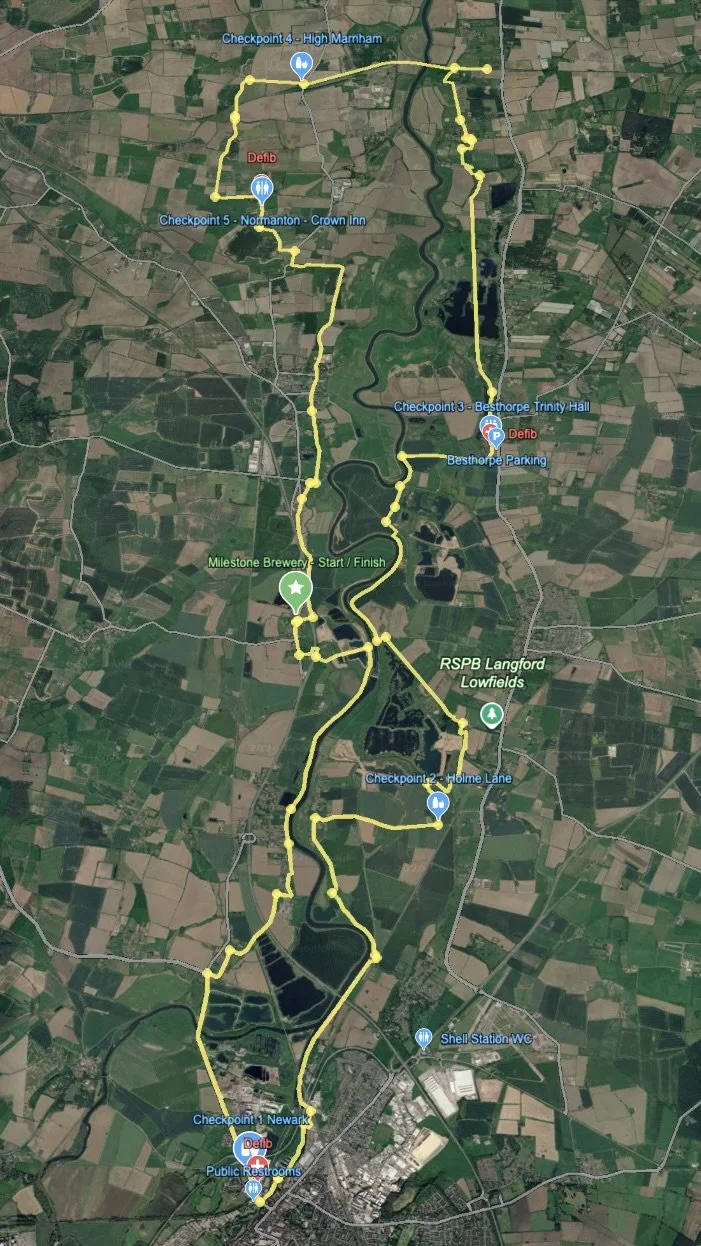
Strava map showing Trent Valley Ultra route with highlighted path in orange, indicating a distance of 31 miles, elevation of 541 feet, and an average pace of 10:22 per mile. Locations such as Newark-on-Trent, Sutton on Trent, and Collingham are marked on the map.
Final Instructions
Map - Start to Checkpoint 1
Route Instructions
Checkpoint 1 to 2
Get GPX files
Checkpoint 2 to 3
Checkpoint 3 to 4
Checkpoint 4 to 5
Checkpoint 5 to Finish